
Sic Semper Tyrannis
Thus always to tyrants
tyrannical leaders will inevitably be overthrown


The Fall Line Road connected the central parts of the Carolinas with Virginia and Georgia...
By 1735 the Fall Line Road (or Southern Road) was the road utilized to connect most of those growing mill towns along the fall line, a geographic drop-off separating the coastal from the piedmont regions. The rivers above each waterfall or rapid were relatively easy to ford because they were not subject to ocean tides, or marshes. Connecting the river fords and nearby mill towns with overland roads helped migration and trade.


The Fall Line Road (aka. Southern Road) forked off of the King's Highway at Fredericksburg, Virginia and continued south running parallel between the King's Highway and the Upper Road. Towns grew at the fall line because cargo on boats had to be portaged around the waterfalls which also served as an important early source of water power. Mills built to harness this resource encouraged the growth of towns. The larger rivers were navigable from the ocean up to the fall line, providing a trade route for those mill towns. The Fall Line Road was historically significant because it was the first into the interior connecting towns away from the coast of Virginia and the Carolinas.

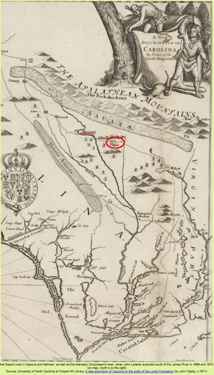
The path was named after the Occaneechi (also Occoneechee, Akenatzy), a small but important tribe who acted as trading middlemen, and who lived primarily on a four-mile long island on the Dan and Roanoke rivers near present-day Clarksville, Virginia. At first the Occaneechi served as contacts between Europeans and Cherokee and other interior tribes. Because of their trade contacts their language was widely used and understood by the leaders of many nations. That location was on the trade route between Petersburg and the Catawba-controlled backcountry in the Carolina Piedmont. The Native Americans who settled at the Occaneechi town could also participate as "middlemen" in the English trade, maintaining connections to Native American groups further west which had better access to deerskins.

In 1727, a settler living near the Iroquoian Meherrin, in a region where some violence had broken out, wrote to the governor of Virginia about the events. He said the Meherrin denied attacking the Nottoway (another Iroquoian tribe). "[T]hey lay the whole blame upon the Occaneechy King and the Saponi Indians." This suggests that English settlers recognized a distinction between the Occaneechi and Saponi.

The Occaneechi

The Occaneechi

Bracey Ancestry Virginia Migration 1700 - 1800

The Occaneechi


Tutelo Saponi Occaneechi in Virginia


Tutelo Saponi Occaneechi in Virginia

Tutelo Saponi Occaneechi in Virginia

Center of Negro Pop. 1790 & 1880 to 1910

Tutelo Saponi Occaneechi in Virginia


"John Blackfeather Jeffries visits Orange County Schools," circa 1987-1996

"John Blackfeather Jeffries visits Orange County Schools," circa 1987-1996

"John Blackfeather Jeffries visits Orange County Schools," circa 1987-1996

"John Blackfeather Jeffries visits Orange County Schools," circa 1987-1996
1700
Francis Bracy

1756
Thomas Bracey


Oxford, NY
Livingston, NY
Egremont, MA
1790 Census
Francis Brazee
[Son of Francis Bracy born in Prince George, VA]


1800 Census
Francis Breese
[Son or Grandson of Francis Bracy born in Prince George, VA]


1810 Census
Francis Brazee
[Grandson of Francis Bracy born in Prince George, VA]


Prince George
Isle of Wight
Norfolk
Brunswick County
Bracey

1820 Census
Randolph Bracey
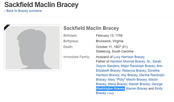
[Father of Sackfield Bracey]


